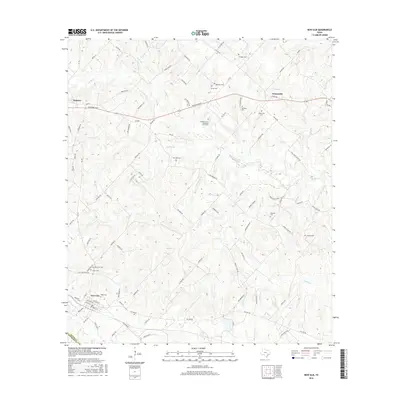
2016 Map of New Ulm
USGS Topo · Published 2016About this map
New Ulm and Industry anchor this rural landscape in the 2010s, where the agricultural traditions of Austin and Colorado counties are clearly etched into the terrain. The map is particularly notable for its dense concentration of small, family-named burial sites, such as the William Lewis Shelburne Farm Cem and the National Cem near Zettel Cem. These features, along with the Hoppe Cem and Heitman Cem, point to a history of multi-generational land ownership and localized settlement patterns that predate the modern road network.
Find a feature on this map
103 named features on this map. Tap any name to fly to it.
Don’t see what you’re looking for? This feature index may not catch every label — zoom into the map to look around manually.
Map Details
Editions of this 2016 New Ulm Map
This is the sole edition of this map. No revisions or reprints were ever made.
Other maps of this area

1919 · Fayettsville
USGS Topo · 1:62,500

1930 · Brenham
USGS Topo · 1:62,500

1953 · Seguin
USGS Topo · 1:250,000

1954 · Austin
USGS Topo · 1:250,000

1956 · Bellville
USGS Topo · 1:62,500

1956 · Brenham
USGS Topo · 1:62,500

1958 · Seguin
USGS Topo · 1:250,000

1958 · Industry
USGS Topo · 1:24,000

1958 · Greenvine
USGS Topo · 1:24,000

1958 · Frelsburg
USGS Topo · 1:24,000