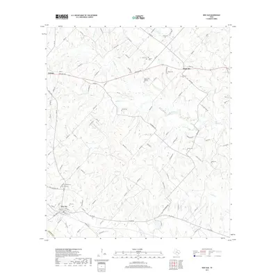
2019 Map of New Ulm
USGS Topo · Published 2019About this map
New Ulm and Nelsonville anchor this Austin County landscape, where the rolling Texas countryside is marked by a high density of family and community burial grounds. This distribution of small, often farm-based cemeteries like the William Lewis Shelburne Farm Cem and Zettel Cem suggests a long-established rural settlement pattern defined by multi-generational family landholdings. In the northern reaches, the town of Industry sits near the headwaters of W Mill Cr, while the central terrain is dissected by an intricate network of waterways including Sandy Cr and Post Oak Point Cr. The road network, comprising routes like FM 109 and Fordtran Blvd, connects these scattered settlements across a landscape still primarily defined by its creeks and farmsteads rather than heavy industrial development.
Find a feature on this map
104 named features on this map. Tap any name to fly to it.
Don’t see what you’re looking for? This feature index may not catch every label — zoom into the map to look around manually.
Map Details
Editions of this 2019 New Ulm Map
This is the sole edition of this map. No revisions or reprints were ever made.
Other maps of this area

1919 · Fayettsville
USGS Topo · 1:62,500

1930 · Brenham
USGS Topo · 1:62,500

1953 · Seguin
USGS Topo · 1:250,000

1954 · Austin
USGS Topo · 1:250,000

1956 · Bellville
USGS Topo · 1:62,500

1956 · Brenham
USGS Topo · 1:62,500

1958 · Seguin
USGS Topo · 1:250,000

1958 · Industry
USGS Topo · 1:24,000

1958 · Greenvine
USGS Topo · 1:24,000

1958 · Frelsburg
USGS Topo · 1:24,000