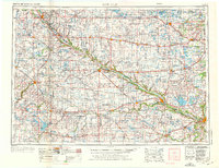
1953 Map of New Ulm
USGS Topo · Published 1976About this map
The Minnesota River carves a deep valley through this agricultural corridor, serving as a primary geographic anchor for numerous settlements and the Upper Sioux Indian Res and Lower Sioux Indian Res. In the mid-1950s, the region was defined by a dense network of small farming communities like Clara City, Olivia, and Glencoe, all connected by the Chicago and North Western railroad and early state highway systems. The landscape is characterized by its transition from the well-watered river valleys to the high ground of Buffalo Ridge.
Find a feature on this map
257 named features on this map. Tap any name to fly to it.
Don’t see what you’re looking for? This feature index may not catch every label — zoom into the map to look around manually.
Map Details
Editions of this 1953 New Ulm Map
3 editions found
Other maps of this area

1950 · Mankato East
USGS Topo · 1:62,500

1951 · Mankato East
USGS Topo · 1:62,500

1951 · Mankato West
USGS Topo · 1:62,500

1952 · Morton
USGS Topo · 1:62,500

1952 · Redwood Falls
USGS Topo · 1:62,500

1953 · Morgan
USGS Topo · 1:62,500

1953 · Milbank
USGS Topo · 1:250,000

1953 · Saint Paul
USGS Topo · 1:250,000

1953 · Watertown
USGS Topo · 1:250,000

1953 · New Ulm
USGS Topo · 1:250,000