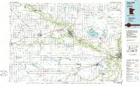
1986 Map of New Ulm
USGS Topo · Published 1986About this map
The Minnesota River carves a deep valley through this agricultural landscape, acting as a primary corridor for both rail and road transit in the mid-1980s. Major regional centers like New Ulm and Mankato anchor the river's path, while the surrounding plains are defined by an extensive drainage network, including Judicial Ditch No 1 and numerous other numbered channels that supported local farming. The Chicago and North Western railroad provides the backbone for smaller prairie settlements such as Sleepy Eye, Springfield, and Madelia.
Find a feature on this map
82 named features on this map. Tap any name to fly to it.
Don’t see what you’re looking for? This feature index may not catch every label — zoom into the map to look around manually.
Map Details
Editions of this 1986 New Ulm Map
This is the sole edition of this map. No revisions or reprints were ever made.
Other maps of this area

1950 · Mankato East
USGS Topo · 1:62,500

1951 · Mankato East
USGS Topo · 1:62,500

1951 · Mankato West
USGS Topo · 1:62,500

1952 · Morton
USGS Topo · 1:62,500

1952 · Redwood Falls
USGS Topo · 1:62,500

1953 · Morgan
USGS Topo · 1:62,500

1953 · Saint Paul
USGS Topo · 1:250,000

1953 · New Ulm
USGS Topo · 1:250,000

1954 · Fairmont
USGS Topo · 1:250,000

1954 · Mason City
USGS Topo · 1:250,000