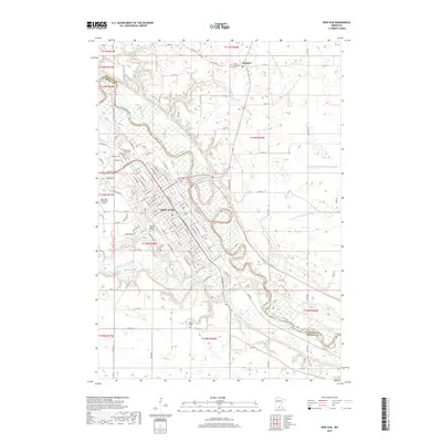
2019 Map of New Ulm
USGS Topo · Published 2019About this map
The Minnesota River and Cottonwood River converge near the heart of New Ulm, defining the geography of this regional hub in the late 2010s. The city's grid is dense with local history, featuring Martin Luther College and several denominational burial grounds including the Catholic Cem, Lutheran Cem, and the New Ulm City Cem. North of the main settlement, the hamlet of Klossner sits at a crossroads near the Salem Methodist Cem, surrounded by a landscape drained by engineered waterways like County Ditch Number 77. This survey illustrates the modern layout of the New Ulm Municipal Airport and the complex interaction between the river bluffs and the surrounding agricultural sections. Farther south, the Saint Josephs Cem remains a quiet landmark along the winding path of the Minnesota River, while the numerous county ditches highlight the intensive land management required for the area's prairie-edge farms.
Find a feature on this map
136 named features on this map. Tap any name to fly to it.
Don’t see what you’re looking for? This feature index may not catch every label — zoom into the map to look around manually.
Map Details
Editions of this 2019 New Ulm Map
This is the sole edition of this map. No revisions or reprints were ever made.
Other maps of this area

1953 · New Ulm
USGS Topo · 1:250,000

1957 · New Ulm
USGS Topo · 1:250,000

1958 · New Ulm
USGS Topo · 1:250,000

1964 · Bernadotte
USGS Topo · 1:24,000

1964 · New Ulm
USGS Topo · 1:24,000

1964 · Courtland
USGS Topo · 1:24,000

1964 · Essig
USGS Topo · 1:24,000

1964 · Lafayette
USGS Topo · 1:24,000

1964 · St George
USGS Topo · 1:24,000

1965 · Hanska
USGS Topo · 1:24,000