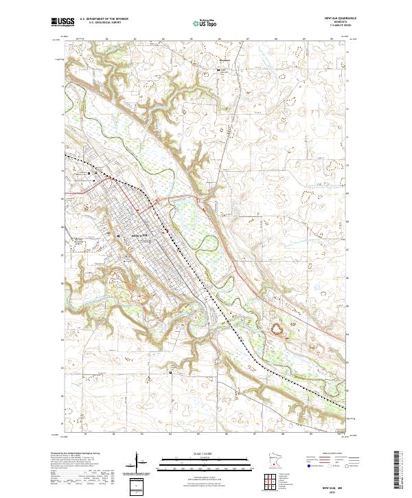
2022 Map of New Ulm
USGS Topo · Published 2022About this map
New Ulm serves as the central hub of this survey, situated at the confluence of the Minnesota River and the Cottonwood River. The town's grid is dense with civic and religious landmarks, including the Brown County Courthouse and the sprawling campus of Martin Luther College. A significant concentration of burial grounds, such as Saint Paul's Lutheran Cem, New Ulm City Cem, and New Ulm Catholic Cem, reflects the long-standing community heritage of this regional center. To the north, the small settlement of Klossner stands along the road network near Salem Methodist Cem. The landscape is defined by a sophisticated system of water management, evident in named features like County Ditch Number Seventy seven and County Ditch Number Eightyone, alongside a modern network of recreational paths including the Minnesota River Trl and Old Island Loop Trl.
Find a feature on this map
146 named features on this map. Tap any name to fly to it.
Don’t see what you’re looking for? This feature index may not catch every label — zoom into the map to look around manually.
Map Details
Editions of this 2022 New Ulm Map
This is the sole edition of this map. No revisions or reprints were ever made.
Other maps of this area

1953 · New Ulm
USGS Topo · 1:250,000

1957 · New Ulm
USGS Topo · 1:250,000

1958 · New Ulm
USGS Topo · 1:250,000

1964 · Bernadotte
USGS Topo · 1:24,000

1964 · New Ulm
USGS Topo · 1:24,000

1964 · Courtland
USGS Topo · 1:24,000

1964 · Essig
USGS Topo · 1:24,000

1964 · Lafayette
USGS Topo · 1:24,000

1964 · St George
USGS Topo · 1:24,000

1965 · Hanska
USGS Topo · 1:24,000