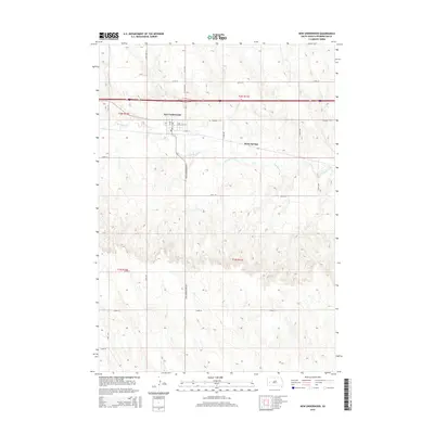
2015 Map of New Underwood
USGS Topo · Published 2015About this map
New Underwood serves as the primary hub of this western South Dakota landscape, situated along the established route of Highway 14-16. The town is organized around a grid of residential and commercial streets, including E Ash St and S A Ave, reflecting its role as a local center for the surrounding ranching and agricultural lands. North of the community, the terrain is partitioned by a network of rural roads such as Viewfield Rd and Honey Bee Ln, which navigate the rises between seasonal watercourses.
Find a feature on this map
27 named features on this map. Tap any name to fly to it.
Don’t see what you’re looking for? This feature index may not catch every label — zoom into the map to look around manually.
Map Details
Editions of this 2015 New Underwood Map
This is the sole edition of this map. No revisions or reprints were ever made.
Other maps of this area

1953 · Viewfield
USGS Topo · 1:24,000

1953 · New Underwood
USGS Topo · 1:24,000

1953 · New Underwood SW
USGS Topo · 1:24,000

1953 · Caputa
USGS Topo · 1:24,000
1953 · New Underwood NW
USGS Topo · 1:24,000

1953 · Caputa NE
USGS Topo · 1:24,000

1953 · Rapid City
USGS Topo · 1:250,000

1954 · Creston
USGS Topo · 1:24,000

1955 · Hot Springs
USGS Topo · 1:250,000

1957 · Rapid City
USGS Topo · 1:250,000