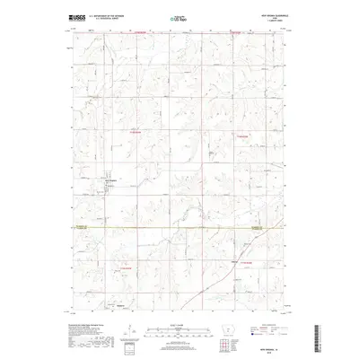
2018 Map of New Virginia
USGS Topo · Published 2018About this map
New Virginia serves as the primary settlement in this portion of south-central Iowa, situated near the headwaters of several drainages including Broadhorn Cr and Box Elder Cr. The landscape is defined by the winding course of the S River in the north and the extensive reach of Squaw Cr through the central and southern sections. This area exhibits a dense concentration of historical burial sites, such as Beymer Cem and Mount Tabor Cem, which provide significant points of interest for genealogical research in Virginia Township.
Find a feature on this map
45 named features on this map. Tap any name to fly to it.
Don’t see what you’re looking for? This feature index may not catch every label — zoom into the map to look around manually.
Map Details
Editions of this 2018 New Virginia Map
This is the sole edition of this map. No revisions or reprints were ever made.
Other maps of this area

1931 · Indianola
USGS Topo · 1:62,500

1950 · New Virginia
USGS Topo · 1:62,500

1951 · Osceola
USGS Topo · 1:62,500

1951 · St. Charles
USGS Topo · 1:62,500

1952 · New Virginia
USGS Topo · 1:62,500

1954 · Des Moines
USGS Topo · 1:250,000

1956 · Des Moines
USGS Topo · 1:250,000

1957 · Des Moines
USGS Topo · 1:250,000

1969 · Des Moines
USGS Topo · 1:250,000
1983 · St. Charles
USGS Topo · 1:24,000