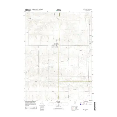
2015 Map of New Windsor
USGS Topo · Published 2015About this map
New Windsor and Alpha anchor this prairie landscape in the mid-2010s, situated where the borders of Mercer, Henry, and Knox Counties meet. The area is defined by a grid of agricultural roads, including Knoxville Rd and Knoxville Trl, which connect the small village centers to the surrounding farms. Local history is anchored by several burial grounds, such as New Windsor Cem, Calvary Cem, and Oxford Cem, which provide valuable location data for genealogists studying the families of the western Illinois corn belt.
Find a feature on this map
51 named features on this map. Tap any name to fly to it.
Don’t see what you’re looking for? This feature index may not catch every label — zoom into the map to look around manually.
Map Details
Editions of this 2015 New Windsor Map
This is the sole edition of this map. No revisions or reprints were ever made.
Other maps of this area

1912 · Milan
USGS Topo · 1:62,500

1923 · Alexis
USGS Topo · 1:62,500

1925 · Alexis
USGS Topo · 1:62,500

1937 · Orion
USGS Topo · 1:62,500

1944 · Milan
USGS Topo · 1:62,500

1947 · Woodhull
USGS Topo · 1:62,500

1953 · Woodhull
USGS Topo · 1:24,000

1953 · Viola
USGS Topo · 1:24,000
1953 · Andover
USGS Topo · 1:24,000
1953 · Matherville
USGS Topo · 1:24,000