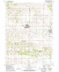
1991 Map of New Windsor
USGS Topo · Published 1992About this map
New Windsor (Windsor) and Alpha serve as the primary hubs in this corner of Mercer and Henry Counties, where the landscape is defined by the headwaters of North Pope Creek and Pope Creek. The map documents a rural transition, notably following the Old Railroad Grade which once connected these farming communities. This corridor remains a focal point for local history, linking the Winola Jr High Sch in the west to the Alwood Sch and Alpha Cem in the east.
Find a feature on this map
32 named features on this map. Tap any name to fly to it.
Don’t see what you’re looking for? This feature index may not catch every label — zoom into the map to look around manually.
Map Details
Editions of this 1991 New Windsor Map
This is the sole edition of this map. No revisions or reprints were ever made.
Other maps of this area

1912 · Milan
USGS Topo · 1:62,500

1923 · Alexis
USGS Topo · 1:62,500

1925 · Alexis
USGS Topo · 1:62,500

1937 · Orion
USGS Topo · 1:62,500

1944 · Milan
USGS Topo · 1:62,500

1947 · Woodhull
USGS Topo · 1:62,500

1953 · Woodhull
USGS Topo · 1:24,000

1953 · Viola
USGS Topo · 1:24,000
1953 · Andover
USGS Topo · 1:24,000
1953 · Matherville
USGS Topo · 1:24,000