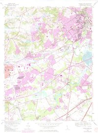
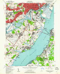
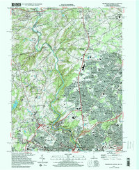
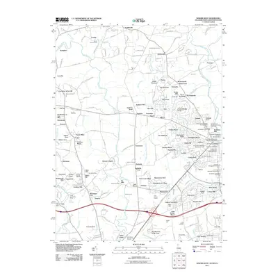
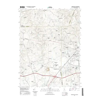
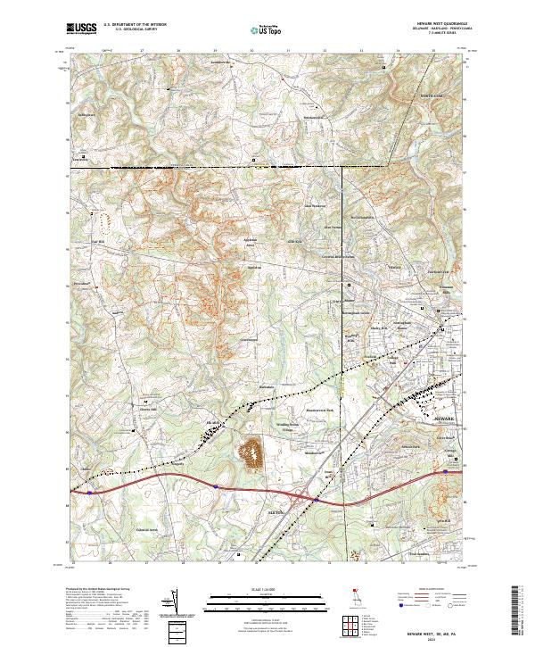
1953 Map of Newark East
USGS Topo · Published 1985About this map
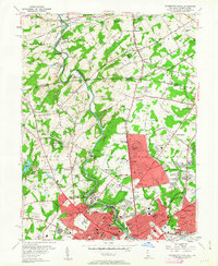
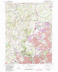
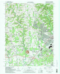
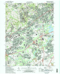
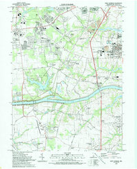
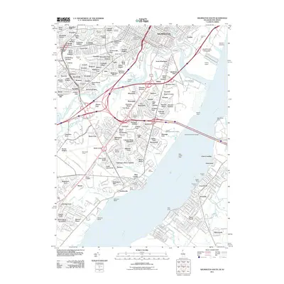
The Newark city boundary and the expanding campus of the University of Delaware anchor the western portion of this 1950s survey, updated in the mid-1980s to reflect post-war suburban growth. The landscape transitions from the institutional core and the U of Del Stadium into a network of residential developments like Brookside and Delaplane Manor. To the east, the historic industrial and transportation corridor along White Clay Creek and Red Clay Creek is clearly visible, with Stanton and Marshallton serving as key nodes. Large-scale regional landmarks, including the Delaware Park Race Track and the Bissell Sanitorium, highlight the varied land use of New Castle County during this era. The map traces the critical rail infrastructure of the Amtrak and Conrail lines, illustrating how the rail-and-road economy shaped the reach of the Pulaski Highway and Kirkwood Highway.
Find a feature on this map
67 named features on this map. Tap any name to fly to it.
Don’t see what you’re looking for? This feature index may not catch every label — zoom into the map to look around manually.
Map Details
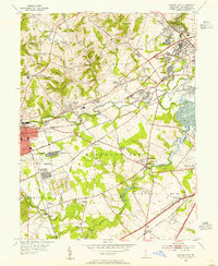
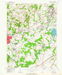
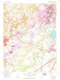
Editions of this 1953 Newark East Map
4 editions found
Historical Maps of Newark Through Time
47 maps found
1948 Taylors Bridge
New Castle County, DE
1948 Wilmington South
New Castle County, DE
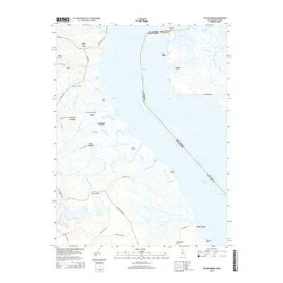
1950 Taylors Bridge
New Castle County, DE
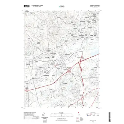
1953 Newark East
New Castle County, DE
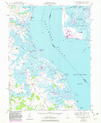
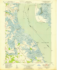
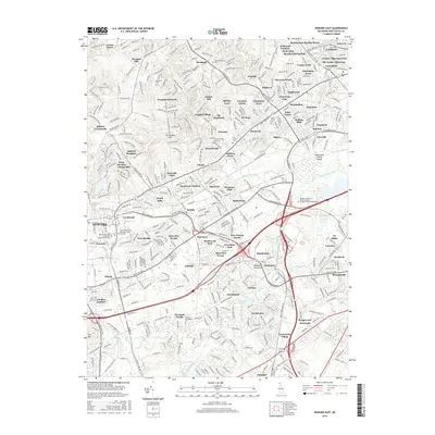
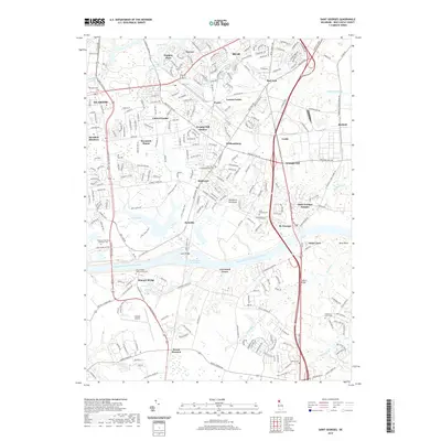
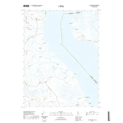
1953 Saint Georges
New Castle County, DE
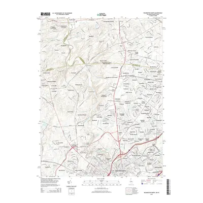
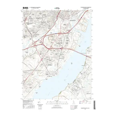
1954 Wilmington North
New Castle County, DE
1967 Wilmington North
New Castle County, DE

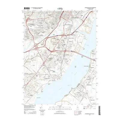
1967 Wilmington South
New Castle County, DE
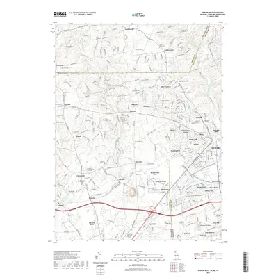
1992 Newark West
New Castle County, DE
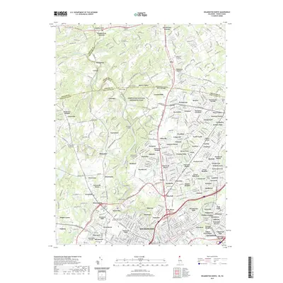
1993 Newark East
New Castle County, DE
1993 Saint Georges
New Castle County, DE
1993 Taylors Bridge
New Castle County, DE
1993 Wilmington North
New Castle County, DE
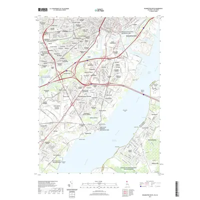
1993 Wilmington South
New Castle County, DE
1997 Wilmington North
New Castle County, DE
1997 Wilmington South
New Castle County, DE
1999 Taylors Bridge
New Castle County, DE
2011 Newark East
New Castle County, DE
2011 Newark West
New Castle County, DE
2011 Saint Georges
New Castle County, DE
2011 Taylors Bridge
New Castle County, DE
2011 Wilmington North
New Castle County, DE
2011 Wilmington South
New Castle County, DE
2014 Newark East
New Castle County, DE
2014 Newark West
New Castle County, DE
2014 Saint Georges
New Castle County, DE
2014 Taylors Bridge
New Castle County, DE
2014 Wilmington North
New Castle County, DE
2014 Wilmington South
New Castle County, DE
2016 Newark East
New Castle County, DE
2016 Newark West
New Castle County, DE
2016 Saint Georges
New Castle County, DE
2016 Taylors Bridge
New Castle County, DE
2016 Wilmington North
New Castle County, DE
2016 Wilmington South
New Castle County, DE
2019 Newark East
New Castle County, DE
2019 Newark West
New Castle County, DE
2019 Saint Georges
New Castle County, DE
2019 Taylors Bridge
New Castle County, DE
2019 Wilmington North
New Castle County, DE
2019 Wilmington South
New Castle County, DE

2023 Newark East
New Castle County, DE
2023 Newark West
New Castle County, DE
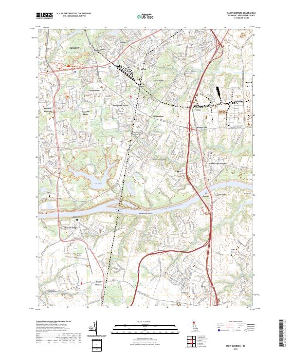
2023 Saint Georges
New Castle County, DE
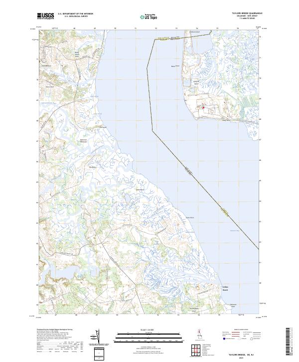
2023 Taylors Bridge
New Castle County, DE
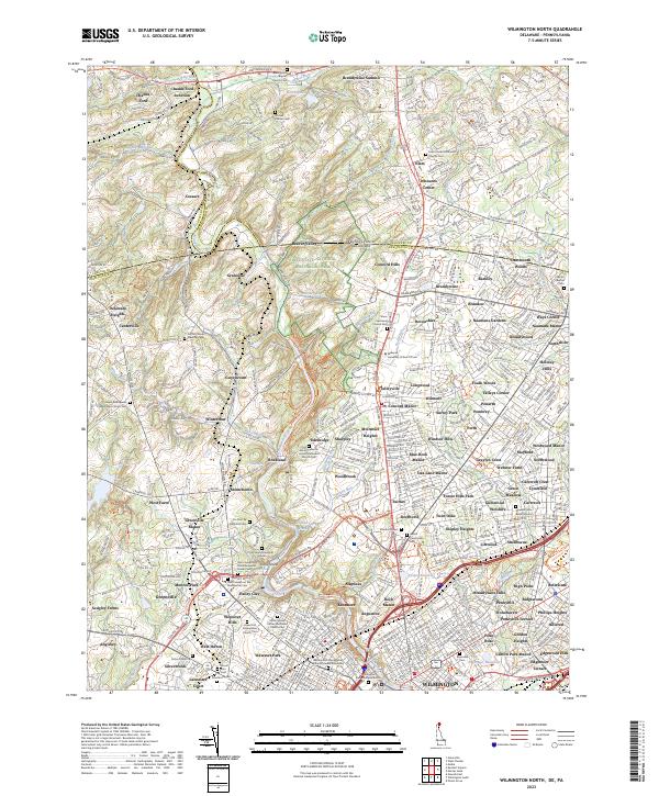
2023 Wilmington North
New Castle County, DE
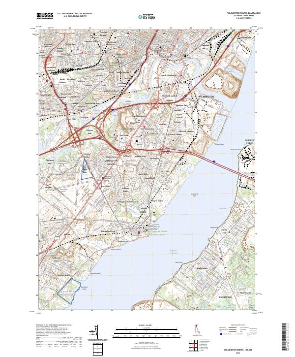
2023 Wilmington South
New Castle County, DE