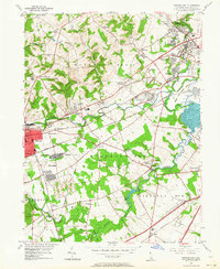
1953 Map of Newark East
USGS Topo · Published 1964About this map
The growing city of Newark anchors the western edge of this mid-century survey, surrounded by established residential developments like Delaplane Manor and Brookside. This era captures the transition of northern New Castle County from a predominantly rural landscape into a suburban corridor, marked by the extensive rail infrastructure of the B & O and Pennsylvania lines that supported local industry. To the east, the Delaware Park Race Track serves as a prominent landmark near the confluence of White Clay Creek and Red Clay Creek.
Find a feature on this map
66 named features on this map. Tap any name to fly to it.
Don’t see what you’re looking for? This feature index may not catch every label — zoom into the map to look around manually.
Map Details
Editions of this 1953 Newark East Map
4 editions found
Other maps of this area

1898 · Elkton
USGS Topo · 1:62,500

1900 · Elkton
USGS Topo · 1:62,500

1901 · West Chester
USGS Topo · 1:62,500

1904 · West Chester
USGS Topo · 1:62,500

1904 · Coatesville
USGS Topo · 1:62,500

1904 · Wilmington
USGS Topo · 1:62,500

1906 · Coatesville
USGS Topo · 1:62,500

1906 · Wilmington
USGS Topo · 1:62,500

1917 · Elkton
USGS Topo · 1:62,500

1918 · Coatesville
USGS Topo · 1:62,500