
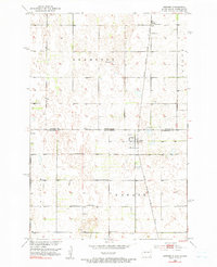
1953 Map of Newark
USGS Topo · Published 1955About this map
The prairie landscape of the North Dakota South Dakota border is captured here during a period of transition in the mid-1950s. The small settlement of Newark sits directly on the state line, serving as a focal point for the surrounding rural townships of Brampton, Taylor, Newark, and Dayton. Transportation through this agricultural region is defined by the Chicago Milwaukee St Paul and Pacific railroad, which runs vertically through the landscape. The map reveals the essential infrastructure of a mid-century farming community, from the Chadwick Sch and Brampton Cem to scattered landmarks like a Windmill and a Flowing Well. This survey was compiled as part of the Department of the Interior program for the development of the Missouri River Basin, documenting the drainage patterns including County Ditch No 2 and numerous small prairie potholes.
Find a feature on this map
14 named features on this map. Tap any name to fly to it.
Don’t see what you’re looking for? This feature index may not catch every label — zoom into the map to look around manually.
Map Details
Editions of this 1953 Newark Map
2 editions found
Other maps of this area

1953 · Britton East
USGS Topo · 1:24,000

1953 · Newark SW
USGS Topo · 1:24,000

1953 · Kidder
USGS Topo · 1:24,000

1953 · Milbank
USGS Topo · 1:250,000

1953 · Fargo
USGS Topo · 1:250,000

1956 · Fargo
USGS Topo · 1:250,000
1956 · Straubville
USGS Topo · 1:24,000

1956 · Britton West
USGS Topo · 1:24,000

1956 · Newark NW
USGS Topo · 1:24,000

1957 · Cogswell
USGS Topo · 1:24,000