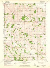
1962 Map of Newark
USGS Topo · Published 1972About this map
The agrarian landscape of Plymouth and Newark townships spans the Wisconsin-Illinois state line in this early 1960s study, later updated with early 1970s photogrammetric data. The village of Orfordville sits in the northwest corner, served by the C&NW railroad. Rural life is anchored by family-named landmarks and local institutions, such as Luther Valley Ch, Fisher Sch, and Pleasant Hill Sch. The terrain is defined by the winding course of Raccoon Creek, which flows southeast toward a Mill Pond and a County Park near the state border. Numerous Gravel Pits and Quarries dot the hillsides, indicating a local economy tied to the land's natural resources. This period captures the region's transition as a Girl Scout Camp and several cemeteries, including Maple Grove Cem, preserve the community's genealogy and social history.
Find a feature on this map
24 named features on this map. Tap any name to fly to it.
Don’t see what you’re looking for? This feature index may not catch every label — zoom into the map to look around manually.
Map Details
Editions of this 1962 Newark Map
3 editions found
Other maps of this area

1891 · Janesville
USGS Topo · 1:62,500

1893 · Janesville
USGS Topo · 1:62,500

1893 · Brodhead
USGS Topo · 1:62,500

1918 · Rockford
USGS Topo · 1:62,500

1932 · Pecatonica
USGS Topo · 1:62,500

1936 · Pecatonica
USGS Topo · 1:62,500

1938 · Rockford
USGS Topo · 1:62,500

1954 · Rockford
USGS Topo · 1:250,000

1955 · Rockford
USGS Topo · 1:250,000

1958 · Rockford
USGS Topo · 1:250,000