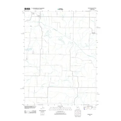
2012 Map of Newark
USGS Topo · Published 2012About this map
Newark anchors the northern reaches of this rural Missouri landscape, where the South Fabius River and Little Fabius River converge amid a complex network of tributaries. The map documents a classic Midwestern agricultural pattern, with the small settlements of Elgin and Steffenville serving as outlying nodes connected by a grid of county and Shelby roads. A notable geographic detail is the Old Channel South Fabius River, which traces the former path of the waterway before natural or engineered shifts altered its course. Genealogists and local historians will find value in the clear marking of the Newark Cemetery and Nelson Cemetery, while watercourses like Tiger Fork, Looney Creek, and Jones Branch define the drainage of the surrounding farmland. The presence of named thoroughfares such as Million St and Mercy St provides specific street-level detail within the village of Newark during this early 21st-century period.
Find a feature on this map
57 named features on this map. Tap any name to fly to it.
Don’t see what you’re looking for? This feature index may not catch every label — zoom into the map to look around manually.
Map Details
Editions of this 2012 Newark Map
This is the sole edition of this map. No revisions or reprints were ever made.
Other maps of this area

1903 · Kahoka
USGS Topo · 1:125,000

1903 · Palmyra
USGS Topo · 1:125,000

1903 · Edina
USGS Topo · 1:125,000

1948 · Quincy
USGS Topo · 1:250,000

1950 · Lewistown
USGS Topo · 1:24,000

1950 · La Belle
USGS Topo · 1:24,000

1951 · La Belle
USGS Topo · 1:24,000
1951 · Lewistown
USGS Topo · 1:24,000

1953 · Moberly
USGS Topo · 1:250,000

1954 · Centerville
USGS Topo · 1:250,000