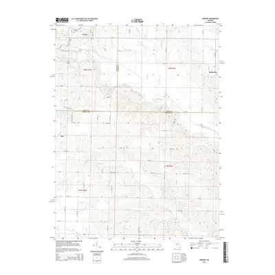
2014 Map of Newark
USGS Topo · Published 2014About this map
Newark and Steffenville anchor this Northeast Missouri landscape where the borders of Knox, Lewis, and Shelby counties meet. The area is defined by the branching watercourses of the Fabius River system, including the South Fabius River, the Little Fabius River, and the S Fabius River. This drainage network, supplemented by numerous creeks like Tiger Fork and Looney Cr, creates a rolling terrain that has long shaped local property lines and travel routes. Genealogists and local historians can locate established burial grounds such as Newark Cemetery near the northern edge of the settlement and Nelson Cemetery to the southwest. The presence of Steffen Lake and the small settlement of Elgin reflect the rural character of the region, while a dense grid of county roads, such as New Creation Rd, provides access to the surrounding timber and agricultural lands across three different townships.
Find a feature on this map
58 named features on this map. Tap any name to fly to it.
Don’t see what you’re looking for? This feature index may not catch every label — zoom into the map to look around manually.
Map Details
Editions of this 2014 Newark Map
This is the sole edition of this map. No revisions or reprints were ever made.
Other maps of this area

1903 · Kahoka
USGS Topo · 1:125,000

1903 · Palmyra
USGS Topo · 1:125,000

1903 · Edina
USGS Topo · 1:125,000

1948 · Quincy
USGS Topo · 1:250,000

1950 · Lewistown
USGS Topo · 1:24,000

1950 · La Belle
USGS Topo · 1:24,000

1951 · La Belle
USGS Topo · 1:24,000
1951 · Lewistown
USGS Topo · 1:24,000

1953 · Moberly
USGS Topo · 1:250,000

1954 · Centerville
USGS Topo · 1:250,000