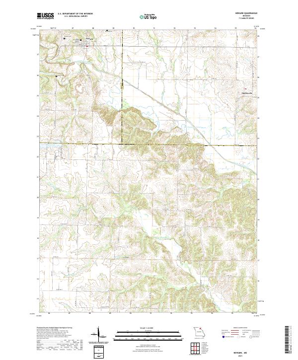
2021 Map of Newark
USGS Topo · Published 2021About this map
The Old Newark Baptist Church and several small burial grounds including Newark Cem, Downing Cem, and Nelson Cem anchor the social landscape of this rural Northeast Missouri region. Centered on the village of Newark, the terrain is defined by the winding course of the South Fabius River and its numerous tributaries like Myers Br and Seebers Br. A notable geographic feature is the Old Channel South Fabius River, which shows the natural shift of the waterway over time, leaving behind a complex network of meanders and stream beds. To the east, the settlement of Steffenville sits near the county line, while Steffen Lake provides a localized water feature to the west. This survey illustrates a resilient agricultural landscape where a dense grid of county roads, such as Co Rd 242 and Co Rd 160, connects isolated homesteads and small community centers.
Find a feature on this map
72 named features on this map. Tap any name to fly to it.
Don’t see what you’re looking for? This feature index may not catch every label — zoom into the map to look around manually.
Map Details
Editions of this 2021 Newark Map
This is the sole edition of this map. No revisions or reprints were ever made.
Other maps of this area

1903 · Kahoka
USGS Topo · 1:125,000

1903 · Palmyra
USGS Topo · 1:125,000

1903 · Edina
USGS Topo · 1:125,000

1948 · Quincy
USGS Topo · 1:250,000

1950 · Lewistown
USGS Topo · 1:24,000

1950 · La Belle
USGS Topo · 1:24,000

1951 · La Belle
USGS Topo · 1:24,000
1951 · Lewistown
USGS Topo · 1:24,000

1953 · Moberly
USGS Topo · 1:250,000

1954 · Centerville
USGS Topo · 1:250,000