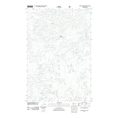
2011 Map of Newaukum Lake
USGS Topo · Published 2011About this map
Newaukum Lake sits as a central hydrological landmark in this 2011 map of Lewis County, Washington, where the drainage systems of several major river basins converge. The map documents a complex network of National Forest development roads, such as Nat For Dev RD 71 and Nat For Dev RD 72, which provide access to high-elevation vantage points including the Newaukum Lookout and Huckleberry Mountain Lookout. This landscape is defined by its verticality, rising from river valleys to prominent peaks like Lookout Peak and Bald Mountain. The presence of these lookout stations indicates the area's strategic importance for forestry management and fire observation. Waterways like the Skookumchuck River, Deschutes River, and North Fork Tilton River originate or pass through this terrain, illustrating the headwaters character of the region. Local history enthusiasts can trace the intricate paths of Winnie Creek and Thorn Creek through the dense topography of Huckleberry Mountain.
Find a feature on this map
29 named features on this map. Tap any name to fly to it.
Don’t see what you’re looking for? This feature index may not catch every label — zoom into the map to look around manually.
Map Details
Editions of this 2011 Newaukum Lake Map
This is the sole edition of this map. No revisions or reprints were ever made.
Other maps of this area

1916 · Chehalis
USGS Topo · 1:125,000

1937 · Eatonville
USGS Topo · 1:125,000

1941 · Tanwax Lake
USGS Topo · 1:62,500

1943 · Willapa
USGS Topo · 1:62,500

1944 · Yelm
USGS Topo · 1:62,500

1944 · Ohop Valley
USGS Topo · 1:62,500

1949 · Ohop Valley
USGS Topo · 1:62,500

1949 · Yelm
USGS Topo · 1:62,500

1953 · Hoquiam
USGS Topo · 1:250,000

1954 · Onalaska
USGS Topo · 1:62,500