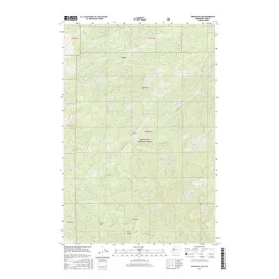
2017 Map of Newaukum Lake
USGS Topo · Published 2017About this map
Newaukum Lake and the high ridges of the Snoqualmie National Forest dominate this landscape in Lewis County, where several major river systems find their headwaters. The map illustrates a complex drainage network where the Skookumchuck River, S Fork Newaukum River, and Deschutes River originate from the steep slopes of Bald Mtn and Huckleberry Mtn. The terrain is marked by significant landmarks like Lookout Peak and the prominent Rooster Rock near the southern boundary. This 2017 survey shows a region primarily managed for timber and conservation, crisscrossed by an extensive network of forestry roads such as Nat For Dev Rd 71 and Nat For Dev Rd 7112. The geography transition is evident as waters flow from Bear Canyon toward the N Fork Tilton River, reflecting the area's role as a vital watershed for the surrounding Pacific Northwest lowlands.
Find a feature on this map
37 named features on this map. Tap any name to fly to it.
Don’t see what you’re looking for? This feature index may not catch every label — zoom into the map to look around manually.
Map Details
Editions of this 2017 Newaukum Lake Map
This is the sole edition of this map. No revisions or reprints were ever made.
Other maps of this area

1916 · Chehalis
USGS Topo · 1:125,000

1937 · Eatonville
USGS Topo · 1:125,000

1941 · Tanwax Lake
USGS Topo · 1:62,500

1943 · Willapa
USGS Topo · 1:62,500

1944 · Yelm
USGS Topo · 1:62,500

1944 · Ohop Valley
USGS Topo · 1:62,500

1949 · Ohop Valley
USGS Topo · 1:62,500

1949 · Yelm
USGS Topo · 1:62,500

1953 · Hoquiam
USGS Topo · 1:250,000

1954 · Onalaska
USGS Topo · 1:62,500