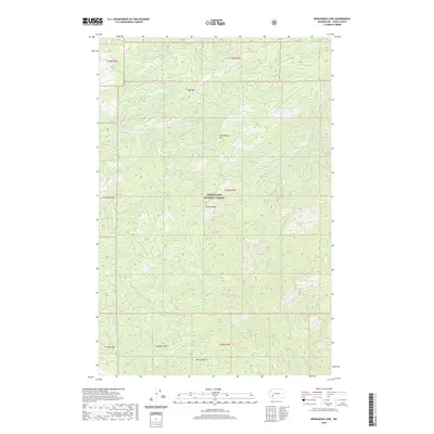
2020 Map of Newaukum Lake
USGS Topo · Published 2020About this map
Snoqualmie National Forest dominates this upland section of Lewis County, where the headwaters of several major regional drainage systems begin their descent. The terrain is defined by significant high points including Lookout Peak, Huckleberry Mtn, and Bald Mtn, which separate the various watersheds. Notably, the map captures the origin of the Deschutes River and its W Fork, alongside the Skookumchuck River and the S Fork Newaukum River. Central to the landscape is Newaukum Lake, a high-elevation water body tucked between steep ridges. The southern portion of the quadrangle drops into Bear Canyon and touches the N Fork Tilton River, showcasing the complex hydrology of the Pacific Northwest. This 2020 update provides a precise look at the forest road network and topographic relief in a region where forestry and watershed management are the primary human imprints.
Find a feature on this map
29 named features on this map. Tap any name to fly to it.
Don’t see what you’re looking for? This feature index may not catch every label — zoom into the map to look around manually.
Map Details
Editions of this 2020 Newaukum Lake Map
This is the sole edition of this map. No revisions or reprints were ever made.
Other maps of this area

1916 · Chehalis
USGS Topo · 1:125,000

1937 · Eatonville
USGS Topo · 1:125,000

1941 · Tanwax Lake
USGS Topo · 1:62,500

1943 · Willapa
USGS Topo · 1:62,500

1944 · Yelm
USGS Topo · 1:62,500

1944 · Ohop Valley
USGS Topo · 1:62,500

1949 · Ohop Valley
USGS Topo · 1:62,500

1949 · Yelm
USGS Topo · 1:62,500

1953 · Hoquiam
USGS Topo · 1:250,000

1954 · Onalaska
USGS Topo · 1:62,500