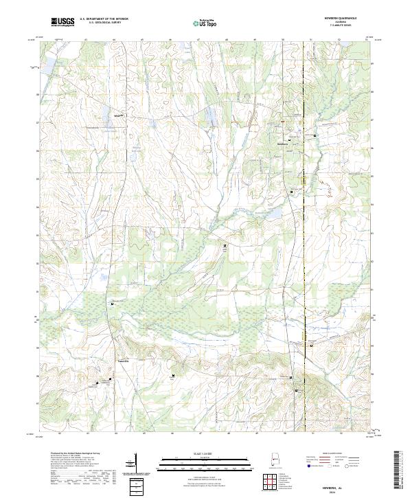
2024 Map of Newbern
USGS Topo · Published 2024About this map
Newbern serves as the central hub of this landscape, where local life centers around streets like School St, Beach St, and Woods St. The surrounding countryside reveals a dense network of family and community history, evidenced by the numerous burial grounds scattered across the terrain, including the Newbern Cem, Hatch Cem, and Alexander Cem. The geography is defined by a slow-moving water system where Big Prairie Creek and Whitsitt Creek wind through the lowlands, creating a patchwork of wetlands and small water bodies like William Dale Lake and Kyser Lakes. Settled crossroads like Whitsitt and Laneville reflect a rural Alabama architecture dictated by the drainage of Dry Creek and Little Prairie Creek, maintaining a settlement pattern that persists into the modern era.
Find a feature on this map
66 named features on this map. Tap any name to fly to it.
Don’t see what you’re looking for? This feature index may not catch every label — zoom into the map to look around manually.
Map Details
Editions of this 2024 Newbern Map
This is the sole edition of this map. No revisions or reprints were ever made.
Other maps of this area

1953 · Montgomery
USGS Topo · 1:250,000

1956 · Montgomery
USGS Topo · 1:250,000

1957 · Montgomery
USGS Topo · 1:250,000

1968 · Uniontown West
USGS Topo · 1:24,000

1968 · Uniontown East
USGS Topo · 1:24,000

1968 · Gallion
USGS Topo · 1:24,000

1979 · Scott Station
USGS Topo · 1:24,000

1979 · Morgan Springs
USGS Topo · 1:24,000

1979 · Greensboro
USGS Topo · 1:24,000
1980 · Casemore
USGS Topo · 1:24,000