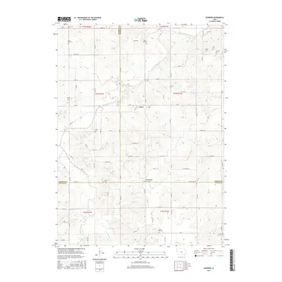
2015 Map of Newbern
USGS Topo · Published 2015About this map
The agrarian landscape of south-central Iowa is defined here by the winding course of White Breast Creek and its many tributaries, including Wolf Cr and Little White Breast Cr. Small, enduring rural settlements such as Newbern and Bauer serve as local anchors, while the outlying community of Rosemount sits at the northern edge of the survey. The region is densely punctuated with historical burial sites, reflecting the generations of family farming that shaped the area. Many of these, such as Saint Paul Cem, Hickory Grove Cem, and Dallas Cem, are situated along the section lines and county roads that grid the undulating terrain. The drainage patterns of Long Br and Winn Br suggest a complex topography of ridges and draws that influenced the placement of original homesteads and local roads like Lucas Co Line Rd.
Find a feature on this map
59 named features on this map. Tap any name to fly to it.
Don’t see what you’re looking for? This feature index may not catch every label — zoom into the map to look around manually.
Map Details
Editions of this 2015 Newbern Map
This is the sole edition of this map. No revisions or reprints were ever made.
Other maps of this area

1909 · Knoxville
USGS Topo · 1:62,500

1910 · Milo
USGS Topo · 1:62,500

1912 · Knoxville
USGS Topo · 1:62,500

1918 · Chariton
USGS Topo · 1:62,500

1924 · Melcher
USGS Topo · 1:62,500

1954 · Des Moines
USGS Topo · 1:250,000

1956 · Des Moines
USGS Topo · 1:250,000

1957 · Des Moines
USGS Topo · 1:250,000

1965 · Milo
USGS Topo · 1:24,000
1965 · Knoxville SW
USGS Topo · 1:24,000
Featured Places
- Melcher-Dallas, IA
- White Breast Township, IA
- Dallas Township, IA
- Franklin Township, IA
- Belmont Township, IA