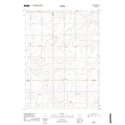
2018 Map of Newbern
USGS Topo · Published 2018About this map
Newbern and Bauer anchor this rural landscape where three Iowa counties — Warren, Marion, and Lucas — meet. The terrain is defined by a dense network of tributaries including White Breast Creek, Little White Breast Cr, and Long Br, which carve through the farmland. For genealogists and local historians, the area is remarkably dense with burial grounds, ranging from Saint Paul Cem and Hickory Grove Cem in the north to Spring Hill Cem and Pine Hill Cem near the southern border. The road network follows a rigid grid of named streets like Virginia St and Waterloo St, yet remains subservient to the meandering paths of Wolf Cr and Wildcat Cr. The map captures a moment of modern rural continuity, where traditional family-named landmarks persist alongside contemporary county highway designations.
Find a feature on this map
56 named features on this map. Tap any name to fly to it.
Don’t see what you’re looking for? This feature index may not catch every label — zoom into the map to look around manually.
Map Details
Editions of this 2018 Newbern Map
This is the sole edition of this map. No revisions or reprints were ever made.
Other maps of this area

1909 · Knoxville
USGS Topo · 1:62,500

1910 · Milo
USGS Topo · 1:62,500

1912 · Knoxville
USGS Topo · 1:62,500

1918 · Chariton
USGS Topo · 1:62,500

1924 · Melcher
USGS Topo · 1:62,500

1954 · Des Moines
USGS Topo · 1:250,000

1956 · Des Moines
USGS Topo · 1:250,000

1957 · Des Moines
USGS Topo · 1:250,000

1965 · Milo
USGS Topo · 1:24,000
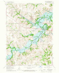
1965 · Knoxville SW
USGS Topo · 1:24,000
Featured Places
- Melcher-Dallas, IA
- White Breast Township, IA
- Dallas Township, IA
- Franklin Township, IA
- Belmont Township, IA