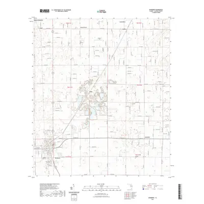
2021 Map of Newberry
USGS Topo · Published 2021About this map
The Newberry township and its surrounding rural hamlets are documented in this modern topographic survey of western Alachua County. The landscape is defined by a dense grid of local roads and several concentrated settlements, including the historical crossroads of Jonesville, Cadillac, and Wade. These areas maintain their distinct identities even as the region transitions toward modern residential development. Genealogists will find significant value in the documentation of local burial grounds, specifically the Forest Grove Cem, Newberry Municipal Cem, and Jonesville Cem. Near the center of the sheet, the settlement of Haile is surrounded by a complex system of local water features and depressions, illustrating the unique karst-like topography of this Florida region. North of the town center, Sullivan Field and the community of Forest Grove serve as additional landmarks for local history research.
Find a feature on this map
81 named features on this map. Tap any name to fly to it.
Don’t see what you’re looking for? This feature index may not catch every label — zoom into the map to look around manually.
Map Details
Editions of this 2021 Newberry Map
This is the sole edition of this map. No revisions or reprints were ever made.
Other maps of this area

1890 · Arredondo
USGS Topo · 1:62,500

1892 · Arredondo
USGS Topo · 1:62,500

1894 · Arredondo
USGS Topo · 1:62,500

1954 · Gainesville
USGS Topo · 1:250,000

1958 · Gainesville
USGS Topo · 1:250,000

1959 · Gainesville
USGS Topo · 1:250,000

1962 · High Springs
USGS Topo · 1:24,000

1966 · Gainesville West
USGS Topo · 1:24,000

1966 · Arredondo
USGS Topo · 1:24,000
1966 · Alachua
USGS Topo · 1:24,000