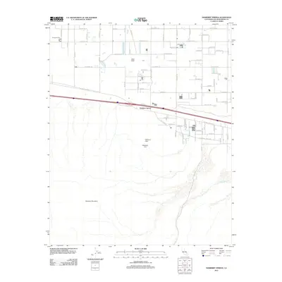
2012 Map of Newberry Springs
USGS Topo · Published 2012About this map
Newberry Springs sits at the foot of the Newberry Mountains in this high-desert landscape from the early 2010s. The settlement pattern is defined by a rigorous grid of rural roads, including Silver Valley Rd and Newberry Rd, which service local ranching and agricultural interests like the Barstow Koi Farm. The infrastructure of the Mojave is evident in the transition from the modern interstate corridor to the older route of the National Trails Hwy, with a local Po serving as a central point for the community. Beyond the developed valley floor, the terrain rises sharply toward the south, marked by prominent features such as Newberry Peak and Newberry Cairn. In the eastern section, the drainage of Kane Wash cuts through the desert floor, while Black Butte stands as a distinct landmark in the northern reaches, illustrating the volcanic geography typical of San Bernardino County.
Find a feature on this map
68 named features on this map. Tap any name to fly to it.
Don’t see what you’re looking for? This feature index may not catch every label — zoom into the map to look around manually.
Map Details
Editions of this 2012 Newberry Springs Map
This is the sole edition of this map. No revisions or reprints were ever made.
Other maps of this area

1953 · San Bernardino
USGS Topo · 1:250,000

1953 · Yermo
USGS Topo · 1:24,000

1955 · Silver Bell Mine
USGS Topo · 1:24,000

1955 · Newberry
USGS Topo · 1:62,500

1955 · Ord Mountains
USGS Topo · 1:62,500

1955 · Rodman Mountains
USGS Topo · 1:62,500

1956 · San Bernardino
USGS Topo · 1:250,000

1956 · Daggett
USGS Topo · 1:62,500

1957 · San Bernardino
USGS Topo · 1:250,000

1958 · San Bernardino
USGS Topo · 1:250,000