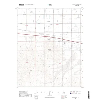
2018 Map of Newberry Springs
USGS Topo · Published 2018About this map
Newberry Springs serves as the focal point of this 2018 survey, positioned at the edge of the Mojave Valley and the broader Mojave Desert. The terrain transitions sharply from the developed grid of the valley floor to the high relief of the Newberry Mountains. Significant landmarks like Newberry Peak and the Newberry Cairn dominate the southern portion of the sheet, while the isolated Black Butte stands as a prominent feature to the north. A dense network of roads, including those with distinctive names like Oahu Rd, Malibu Ave, and Toy Truck Trl, reveals a landscape of rural residential development and desert access routes. The seasonal drainage of Kane Wash and the namesake Newberry Spring provide the primary hydrological context for this arid region.
Find a feature on this map
72 named features on this map. Tap any name to fly to it.
Don’t see what you’re looking for? This feature index may not catch every label — zoom into the map to look around manually.
Map Details
Editions of this 2018 Newberry Springs Map
This is the sole edition of this map. No revisions or reprints were ever made.
Other maps of this area

1953 · San Bernardino
USGS Topo · 1:250,000

1953 · Yermo
USGS Topo · 1:24,000

1955 · Silver Bell Mine
USGS Topo · 1:24,000

1955 · Newberry
USGS Topo · 1:62,500

1955 · Ord Mountains
USGS Topo · 1:62,500

1955 · Rodman Mountains
USGS Topo · 1:62,500

1956 · San Bernardino
USGS Topo · 1:250,000

1956 · Daggett
USGS Topo · 1:62,500

1957 · San Bernardino
USGS Topo · 1:250,000

1958 · San Bernardino
USGS Topo · 1:250,000