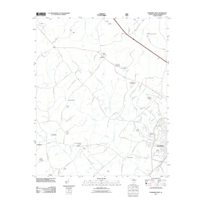
2011 Map of Newberry West
USGS Topo · Published 2011About this map
The western outskirts of Newberry and the adjacent community of Helena anchor this survey, revealing a landscape where industrial heritage and agriculture meet. The Oakland Mill stands near the edge of town, while the surrounding countryside is defined by the winding course of the Bush River and Big Beaverdam Creek. Small crossroads settlements like Jalapa, Gary, and Smyrna dot the rural areas, often identified by local landmarks such as the Saint James Cemetery or Smyrna Cemetery. Numerous ponds, including Parrs Pond Number One, suggest a managed water system supporting both agriculture and industry. The presence of specialized operations like Iron's Poultry Farm and Mayer Farms indicates a transition from traditional crops to diverse agribusiness. Transportation is highlighted by significant crossings like Sends Mill Bridge and O'Neall Bridge, which have long connected these rural communities to the regional center.
Find a feature on this map
93 named features on this map. Tap any name to fly to it.
Don’t see what you’re looking for? This feature index may not catch every label — zoom into the map to look around manually.
Map Details
Editions of this 2011 Newberry West Map
This is the sole edition of this map. No revisions or reprints were ever made.
Other maps of this area

1941 · Spartanburg
USGS Topo · 1:250,000

1953 · Spartanburg
USGS Topo · 1:250,000

1960 · Spartanburg
USGS Topo · 1:250,000

1963 · Spartanburg
USGS Topo · 1:250,000

1964 · Spartanburg
USGS Topo · 1:250,000

1968 · Newberry East
USGS Topo · 1:24,000

1969 · Whitmire South
USGS Topo · 1:24,000

1969 · Newberry NW
USGS Topo · 1:24,000

1969 · Newberry West
USGS Topo · 1:24,000
1970 · Prosperity
USGS Topo · 1:24,000