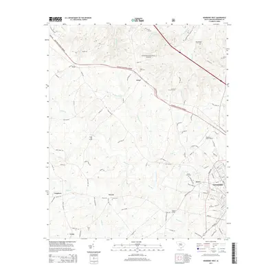
2014 Map of Newberry West
USGS Topo · Published 2014About this map
The western reaches of Newberry and the adjacent community of Helena anchor this landscape, where the urban grid gives way to the wooded expanses of the Sumter National Forest. The geography is defined by the winding course of the Bush River, which is crossed by notable local landmarks such as Sends Mill Bridge and ONeall Bridge. These crossings, alongside numerous family and church cemeteries like Smyrna Cem and Browns Chapel Cem, trace the generational settlement patterns of Newberry County. Smaller hamlets and junctions including Jalapa, Gary, and Smyrna are connected by a network of rural routes like Belfast Rd and Bush River Rd. This area reflects a long-standing balance between established residential centers, agricultural land, and protected forest, with the Newberry County Airport serving as a modern transportation hub near the heart of the county seat.
Find a feature on this map
108 named features on this map. Tap any name to fly to it.
Don’t see what you’re looking for? This feature index may not catch every label — zoom into the map to look around manually.
Map Details
Editions of this 2014 Newberry West Map
This is the sole edition of this map. No revisions or reprints were ever made.
Other maps of this area

1941 · Spartanburg
USGS Topo · 1:250,000

1953 · Spartanburg
USGS Topo · 1:250,000

1960 · Spartanburg
USGS Topo · 1:250,000

1963 · Spartanburg
USGS Topo · 1:250,000

1964 · Spartanburg
USGS Topo · 1:250,000

1968 · Newberry East
USGS Topo · 1:24,000

1969 · Whitmire South
USGS Topo · 1:24,000

1969 · Newberry NW
USGS Topo · 1:24,000

1969 · Newberry West
USGS Topo · 1:24,000
1970 · Prosperity
USGS Topo · 1:24,000