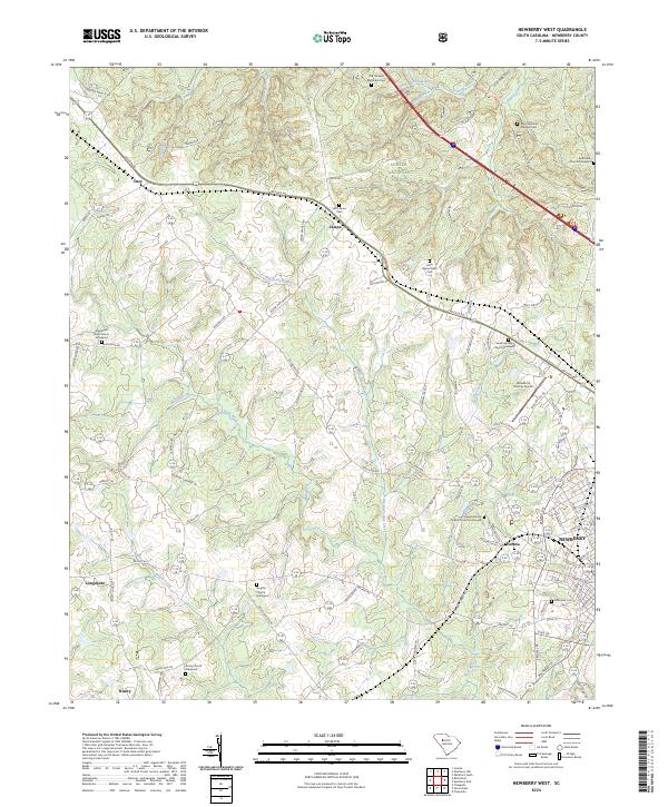
2024 Map of Newberry West
USGS Topo · Published 2024About this map
The rolling Piedmont landscape of Newberry County is defined here by a network of rural hamlets and historic church grounds that anchor the countryside. Settlements like Jalapa, Gary, and Helena are interconnected by a dense web of local routes including Wilson Rd and Bush River Rd. This survey highlights a deeply rooted community structure, where family and congregational history is preserved at sites such as the Smyrna Church Graveyard and Trinity Church Graveyard.
Find a feature on this map
110 named features on this map. Tap any name to fly to it.
Don’t see what you’re looking for? This feature index may not catch every label — zoom into the map to look around manually.
Map Details
Editions of this 2024 Newberry West Map
This is the sole edition of this map. No revisions or reprints were ever made.
Other maps of this area

1941 · Spartanburg
USGS Topo · 1:250,000

1953 · Spartanburg
USGS Topo · 1:250,000

1960 · Spartanburg
USGS Topo · 1:250,000

1963 · Spartanburg
USGS Topo · 1:250,000

1964 · Spartanburg
USGS Topo · 1:250,000

1968 · Newberry East
USGS Topo · 1:24,000

1969 · Whitmire South
USGS Topo · 1:24,000

1969 · Newberry NW
USGS Topo · 1:24,000

1969 · Newberry West
USGS Topo · 1:24,000
1970 · Prosperity
USGS Topo · 1:24,000