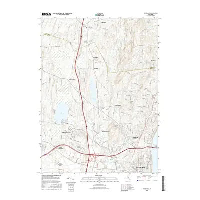
2016 Map of Newburgh
USGS Topo · Published 2016About this map
Newburgh anchors the southeastern corner of this study, positioned where the Newburgh-Beacon Bridge spans the water. The landscape transitions from the urban density of the riverfront to the suburban and rural stretches of Balmville, Gardnertown, and Leptondale. A network of water bodies, including Chadwick Lake and Orange Lake, defines the central terrain, while Marlboro Mtn and Cronomer Hill provide significant topographic relief.
Find a feature on this map
194 named features on this map. Tap any name to fly to it.
Don’t see what you’re looking for? This feature index may not catch every label — zoom into the map to look around manually.
Map Details
Editions of this 2016 Newburgh Map
This is the sole edition of this map. No revisions or reprints were ever made.
Other maps of this area

1892 · West Point
USGS Topo · 1:62,500

1893 · Poughkeepsie
USGS Topo · 1:62,500

1894 · West Point
USGS Topo · 1:62,500

1894 · Poughkeepsie
USGS Topo · 1:62,500

1899 · West Point
USGS Topo · 1:62,500

1901 · West Point
USGS Topo · 1:62,500

1902 · Schunemunk
USGS Topo · 1:62,500

1903 · Poughkeepsie
USGS Topo · 1:62,500

1903 · Newburg
USGS Topo · 1:62,500

1930 · Schunemunk
USGS Topo · 1:48,000