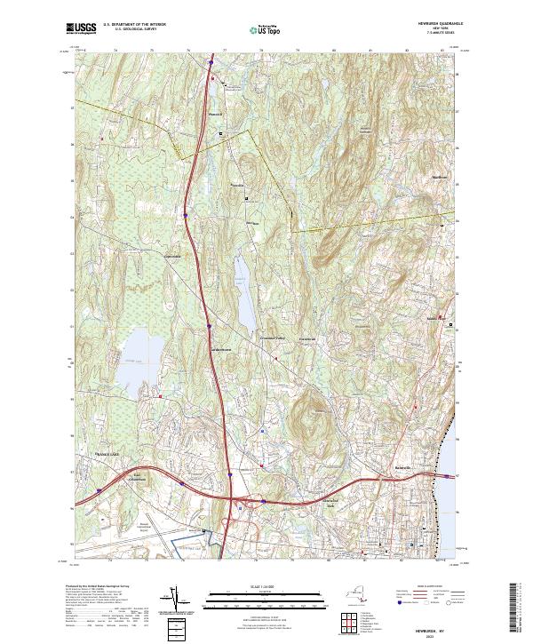
2023 Map of Newburgh
USGS Topo · Published 2023About this map
Stewart International Airport anchors the southern reaches of this landscape, marking a modern transport hub situated amidst the historical hamlets of East Coldenham and Glenwood Park. To the north, the terrain rises toward the Marlboro Mountains and Cronomer Hill, where the Delaware Aqueduct cuts a subterranean path through the ridge. The map illustrates a dense network of residential corridors and small communities like Gardnertown and Cronomer Valley, which have grown around natural water features such as Chadwick Lake and Orange Lake. Genealogists will find several notable burial grounds, including the Old Town Cem and the Plattekill Valley Community Cem, alongside institutional landmarks like Mount Saint Mary College. The transition between Ulster and Orange counties is clearly defined, showing how suburban development has integrated with the area's older agricultural and village roots.
Find a feature on this map
212 named features on this map. Tap any name to fly to it.
Don’t see what you’re looking for? This feature index may not catch every label — zoom into the map to look around manually.
Map Details
Editions of this 2023 Newburgh Map
This is the sole edition of this map. No revisions or reprints were ever made.
Other maps of this area

1892 · West Point
USGS Topo · 1:62,500

1893 · Poughkeepsie
USGS Topo · 1:62,500

1894 · West Point
USGS Topo · 1:62,500

1894 · Poughkeepsie
USGS Topo · 1:62,500

1899 · West Point
USGS Topo · 1:62,500

1901 · West Point
USGS Topo · 1:62,500

1902 · Schunemunk
USGS Topo · 1:62,500

1903 · Poughkeepsie
USGS Topo · 1:62,500

1903 · Newburg
USGS Topo · 1:62,500

1930 · Schunemunk
USGS Topo · 1:48,000