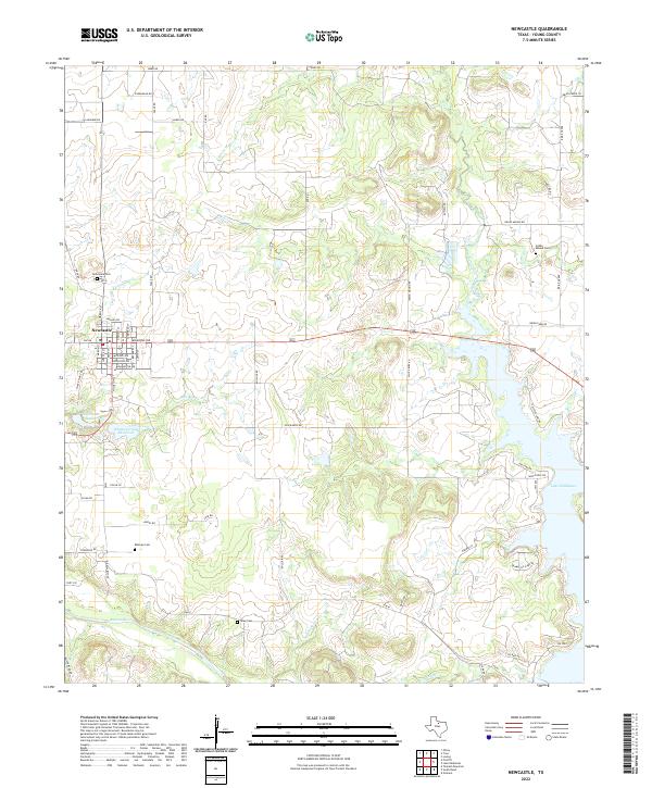
2022 Map of Newcastle
USGS Topo · Published 2022About this map
Newcastle serves as the central hub of this North Texas landscape, where the street grid is clearly defined by historical names like Madison Ave and Washington Ave. The terrain is characterized by a series of significant water bodies and drainages that shape the local geography, including Whiskey Creek Reservoir and the northern reaches of Lake Eddleman. To the south, the Brazos River meanders across the territory, joined by tributaries such as Jim Anderson Cr and Brier Br.
Find a feature on this map
62 named features on this map. Tap any name to fly to it.
Don’t see what you’re looking for? This feature index may not catch every label — zoom into the map to look around manually.
Map Details
Editions of this 2022 Newcastle Map
This is the sole edition of this map. No revisions or reprints were ever made.
Other maps of this area

1924 · Graham 4-d
USGS Topo · 1:48,000

1925 · Graham 4-c
USGS Topo · 1:48,000

1927 · Graham
USGS Topo · 1:62,500

1954 · Wichita Falls
USGS Topo · 1:250,000

1958 · Wichita Falls
USGS Topo · 1:250,000

1964 · Newcastle
USGS Topo · 1:24,000

1964 · True
USGS Topo · 1:24,000

1964 · Loving
USGS Topo · 1:24,000

1964 · Lake Eddleman
USGS Topo · 1:24,000

1964 · Olney
USGS Topo · 1:24,000