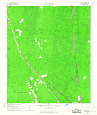
1966 Map of Newell
USGS Topo · Published 1967About this map
Trail Ridge and the edge of the Okefenokee Swamp define this Charlton County landscape, where the Atlantic Coast Line railroad dictates the pattern of settlement. Small rail-stop communities like Uptonville, Newell, and Mattox are spaced along the tracks, interspersed with loading points such as Cypress Siding and Burch Siding. The map reveals the intricate drainage of the swamp fringe, where Spanish Creek and its namesake branch wind through a series of named islands, including Sandy and Rabbit. Local life is anchored by rural landmarks like Sand Hill Ch and Grace Chapel, while the Winokur Lookout Tower and a Radio Tower rise above the dense thickets and valleys. The presence of several family-named roads, such as Mizell Road and Crews Road, provides a clear view of the mid-century transportation network connecting these isolated timber and rail outposts.
Find a feature on this map
36 named features on this map. Tap any name to fly to it.
Don’t see what you’re looking for? This feature index may not catch every label — zoom into the map to look around manually.
Map Details
Editions of this 1966 Newell Map
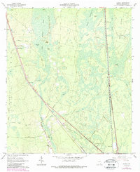
2 editions found
Other maps of this area

1917 · Nahunta
USGS Topo · 1:62,500

1917 · Boulogne
USGS Topo · 1:62,500

1918 · Folkston
USGS Topo · 1:62,500

1918 · Nahunta
USGS Topo · 1:62,500

1919 · Boulogne
USGS Topo · 1:62,500

1946 · Brunswick
USGS Topo · 1:250,000

1948 · Jacksonville
USGS Topo · 1:250,000

1948 · Brunswick
USGS Topo · 1:250,000

1953 · Waycross
USGS Topo · 1:250,000

1954 · Valdosta
USGS Topo · 1:250,000