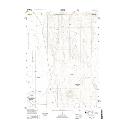
2015 Map of Newell
USGS Topo · Published 2015About this map
The World War II Valor in the Pacific National Monument anchors the southwestern corner of this survey, marking the historically significant site of the Tule Lake Segregation Center near Newell. The landscape is a study in reclaimed basin floor and rising volcanic uplands, where the rigid grid of agricultural roads like Main E W Rd and irrigation infrastructure such as the J Canal meet the irregular terrain of Modoc National Forest. Prominent volcanic features including Carr Butte, Horse Mtn, and Little Horse Mtn rise above the flats, providing clear landmarks for the region. To the north, the boundary between Klamath and Modoc Counties aligns with the Oregon-California border, while seasonal hydrology is evidenced by Tucker Lake and Mud Lake in the lower reaches of the basin.
Find a feature on this map
42 named features on this map. Tap any name to fly to it.
Don’t see what you’re looking for? This feature index may not catch every label — zoom into the map to look around manually.
Map Details
Editions of this 2015 Newell Map
This is the sole edition of this map. No revisions or reprints were ever made.
Other maps of this area

1886 · Modoc Lava Bed
USGS Topo · 1:250,000

1889 · Klamath
USGS Topo · 1:250,000

1892 · Modoc Lava-Bed
USGS Topo · 1:250,000

1894 · Klamath
USGS Topo · 1:250,000

1951 · Clear Lake Reservoir
USGS Topo · 1:62,500

1951 · Tulelake
USGS Topo · 1:62,500

1954 · Alturas
USGS Topo · 1:250,000

1955 · Klamath Falls
USGS Topo · 1:250,000

1957 · Malin
USGS Topo · 1:62,500

1958 · Alturas
USGS Topo · 1:250,000