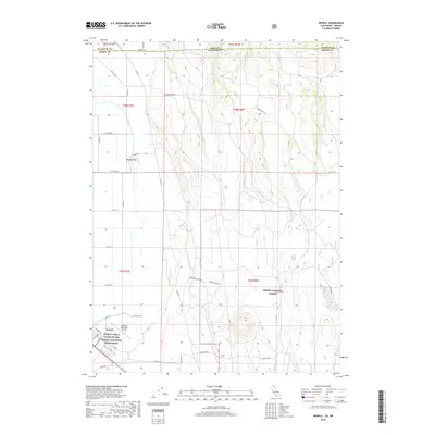
2018 Map of Newell
USGS Topo · Published 2018About this map
Newell sits at the southern edge of this landscape, a site of profound historical weight as the location of the World War II Valor in the Pacific National Monument. The settlement is organized on a rigid street grid including 5th Ave and 6th Ave, adjacent to the Tulelake Municipal Airport. To the north, the terrain transitions into the high desert and volcanic plateaus characteristic of the Modoc National Forest. This 2018 survey reveals a landscape shaped by water management and topography, with the J Canal and D-Canal cutting through the flats near Bloody Point. Rising above the valley floor, the rugged heights of Horse Mountain and the water source at Bull Spring reflect the traditional ranching and natural character of the California-Oregon borderlands.
Find a feature on this map
43 named features on this map. Tap any name to fly to it.
Don’t see what you’re looking for? This feature index may not catch every label — zoom into the map to look around manually.
Map Details
Editions of this 2018 Newell Map
This is the sole edition of this map. No revisions or reprints were ever made.
Other maps of this area

1886 · Modoc Lava Bed
USGS Topo · 1:250,000

1889 · Klamath
USGS Topo · 1:250,000

1892 · Modoc Lava-Bed
USGS Topo · 1:250,000

1894 · Klamath
USGS Topo · 1:250,000

1951 · Clear Lake Reservoir
USGS Topo · 1:62,500

1951 · Tulelake
USGS Topo · 1:62,500

1954 · Alturas
USGS Topo · 1:250,000

1955 · Klamath Falls
USGS Topo · 1:250,000

1957 · Malin
USGS Topo · 1:62,500

1958 · Alturas
USGS Topo · 1:250,000