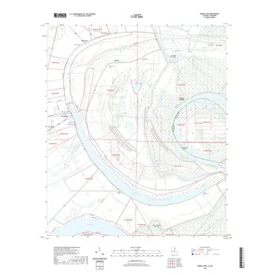
2020 Map of Newellton
USGS Topo · Published 2020About this map
Lake Saint Joseph and the sprawling oxbows of the Mississippi River dominate this landscape on the border of Louisiana and Mississippi. The town of Newellton serves as the local hub, established near the banks of the lake and surrounded by numerous family and community burial sites, including the Newellton Cem, Routhwood Cem, and Wyoming Cem. The area’s complex alluvial geography is defined by former river channels and drainage features like River Sticks and the Buckridge Crevasse. Land use is primarily agricultural and aviation-focused, as seen at the Delta Dusters LLC Airport. Settlement patterns follow the higher ground of the ridges, with small communities like Balmoral, Notnac, and Buck Ridge scattered between the fertile bottomlands and the river’s Hard Times Bend.
Find a feature on this map
61 named features on this map. Tap any name to fly to it.
Don’t see what you’re looking for? This feature index may not catch every label — zoom into the map to look around manually.
Map Details
Editions of this 2020 Newellton Map
This is the sole edition of this map. No revisions or reprints were ever made.
Other maps of this area

1909 · Delta Bridge
USGS Topo · 1:24,000

1909 · Lake Bruen
USGS Topo · 1:24,000

1935 · Shackleford Lake
USGS Topo · 1:62,500

1939 · Lorman
USGS Topo · 1:62,500

1939 · Locust Ridge
USGS Topo · 1:62,500

1953 · Natchez
USGS Topo · 1:250,000

1955 · Jackson
USGS Topo · 1:250,000

1956 · Natchez
USGS Topo · 1:250,000

1958 · Shackleford Lake
USGS Topo · 1:62,500

1958 · St. Joseph
USGS Topo · 1:62,500