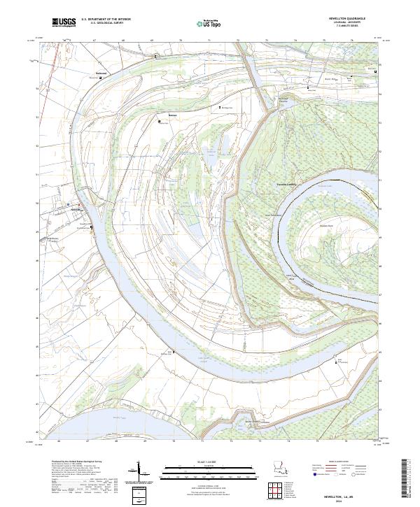
2024 Map of Newellton
USGS Topo · Published 2024About this map
The crescent-shaped Lake Saint Joseph dominates the landscape west of the Mississippi River, marking an ancient oxbow that now frames the town of Newellton. This 2024 survey captures the intricate relationship between the alluvial topography and Tensas Parish settlement patterns. Small hamlets like Balmoral and Notnac sit among a dense network of local routes, including Middle Rd and Parish Rd 329, while larger water bodies like Yucatan Lake and Brushy Lake illustrate the dynamic shifts of the river system over time.
Find a feature on this map
60 named features on this map. Tap any name to fly to it.
Don’t see what you’re looking for? This feature index may not catch every label — zoom into the map to look around manually.
Map Details
Editions of this 2024 Newellton Map
This is the sole edition of this map. No revisions or reprints were ever made.
Other maps of this area

1909 · Delta Bridge
USGS Topo · 1:24,000

1909 · Lake Bruen
USGS Topo · 1:24,000

1935 · Shackleford Lake
USGS Topo · 1:62,500

1939 · Lorman
USGS Topo · 1:62,500

1939 · Locust Ridge
USGS Topo · 1:62,500

1953 · Natchez
USGS Topo · 1:250,000

1955 · Jackson
USGS Topo · 1:250,000

1956 · Natchez
USGS Topo · 1:250,000

1958 · Shackleford Lake
USGS Topo · 1:62,500

1958 · St. Joseph
USGS Topo · 1:62,500