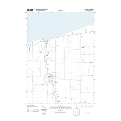
2013 Map of Newfane
USGS Topo · Published 2013About this map
Lake Ontario defines the northern boundary of this Niagara County landscape, where the settlement of Olcott serves as a lakeside hub anchored by the Olcott Light and Newfane Marina. Moving inland, the terrain follows the winding path of Eighteenmile Cr, connecting the village of Newfane with outlying hamlets like Burt and Corwin. This 2013 survey illustrates a region deeply tied to its agricultural roots, evidenced by the numerous named properties such as Singer Farms, Appleton Farms, and the Stedman Old Farm Nurseries. Genealogists will find significant value in the distribution of local burial grounds, including Lakeview Cem, Saint Charles Cem, and the remote Sawyer Cem near the eastern edge. The map also documents local infrastructure ranging from the Olcott-Newfane Airport to the various creeks like Keg Cr and Hopkins Cr that drain the fertile orchards and fields toward the lake.
Find a feature on this map
85 named features on this map. Tap any name to fly to it.
Don’t see what you’re looking for? This feature index may not catch every label — zoom into the map to look around manually.
Map Details
Editions of this 2013 Newfane Map
This is the sole edition of this map. No revisions or reprints were ever made.
Other maps of this area

1894 · Wilson
USGS Topo · 1:62,500

1897 · Tonawanda
USGS Topo · 1:62,500

1897 · Olcott
USGS Topo · 1:62,500

1897 · Lockport
USGS Topo · 1:62,500

1899 · Niagara
USGS Topo · 1:125,000

1900 · Wilson
USGS Topo · 1:62,500

1900 · Tonawanda
USGS Topo · 1:62,500

1901 · Tonawanda
USGS Topo · 1:62,500

1902 · Lockport
USGS Topo · 1:62,500

1905 · Lockport
USGS Topo · 1:62,500