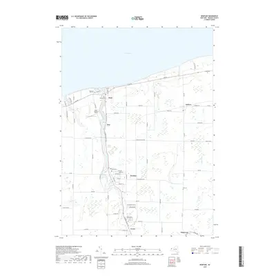
2019 Map of Newfane
USGS Topo · Published 2019About this map
The Lake Ontario shoreline defines the northern edge of this Niagara County landscape, where the waters of Eighteenmile Creek flow through the hamlets of Burt and Olcott. This area is characterized by its agricultural corridors and small-town centers connected by historic routes like Lockport Olcott Rd and Transit Rd. The map reveals a high density of burial grounds essential for genealogical research, including Saint Charles Borromeo Cem, Lakeview Cem, and Sawyer Cem. Inland, the settlement of Newfane serves as a central hub, flanked by the Olcott-Newfane Airport and several smaller communities like Corwin and Appleton. The drainage patterns of Keg Cr, Hopkins Cr, and Golden Hill Cr illustrate the natural irrigation of the coastal plain, which has supported local orchards and farmsteads for generations.
Find a feature on this map
69 named features on this map. Tap any name to fly to it.
Don’t see what you’re looking for? This feature index may not catch every label — zoom into the map to look around manually.
Map Details
Editions of this 2019 Newfane Map
This is the sole edition of this map. No revisions or reprints were ever made.
Other maps of this area

1894 · Wilson
USGS Topo · 1:62,500

1897 · Tonawanda
USGS Topo · 1:62,500

1897 · Olcott
USGS Topo · 1:62,500

1897 · Lockport
USGS Topo · 1:62,500

1899 · Niagara
USGS Topo · 1:125,000

1900 · Wilson
USGS Topo · 1:62,500

1900 · Tonawanda
USGS Topo · 1:62,500

1901 · Tonawanda
USGS Topo · 1:62,500

1902 · Lockport
USGS Topo · 1:62,500

1905 · Lockport
USGS Topo · 1:62,500