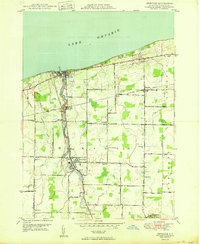
1950 Map of Newfane
USGS Topo · Published 1950About this map
Eighteenmile Creek defines the local geography as it flows north toward Lake Ontario, anchoring the settlements of Newfane and Burt. By 1950, this area of Niagara County shows a mature agricultural and residential landscape structured by the New York Central Railroad and a dense network of country roads. The shoreline at Olcott serves as a focal point for the region, featuring the Newfane Filtration Plant and Krull Park.
Find a feature on this map
55 named features on this map. Tap any name to fly to it.
Don’t see what you’re looking for? This feature index may not catch every label — zoom into the map to look around manually.
Map Details
Editions of this 1950 Newfane Map
This is the sole edition of this map. No revisions or reprints were ever made.
Other maps of this area

1894 · Wilson
USGS Topo · 1:62,500

1897 · Tonawanda
USGS Topo · 1:62,500

1897 · Olcott
USGS Topo · 1:62,500

1897 · Lockport
USGS Topo · 1:62,500

1899 · Niagara
USGS Topo · 1:125,000

1900 · Wilson
USGS Topo · 1:62,500

1900 · Tonawanda
USGS Topo · 1:62,500

1901 · Tonawanda
USGS Topo · 1:62,500

1902 · Lockport
USGS Topo · 1:62,500

1905 · Lockport
USGS Topo · 1:62,500