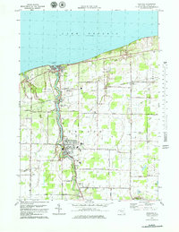
1978 Map of Newfane
USGS Topo · Published 1979About this map
Eighteenmile Creek defines the local topography as it flows north toward Olcott and the shoreline of Lake Ontario. In the late 1970s, this portion of Niagara County remained characterized by its agricultural corridors and scattered crossroad settlements like Burt and Appleton. The transition from the lakefront to the inland orchards and fields is marked by prominent local landmarks, including the historic Krull Park and the small Palmer Airport.
Find a feature on this map
57 named features on this map. Tap any name to fly to it.
Don’t see what you’re looking for? This feature index may not catch every label — zoom into the map to look around manually.
Map Details
Editions of this 1978 Newfane Map
This is the sole edition of this map. No revisions or reprints were ever made.
Other maps of this area

1894 · Wilson
USGS Topo · 1:62,500

1897 · Tonawanda
USGS Topo · 1:62,500

1897 · Olcott
USGS Topo · 1:62,500

1897 · Lockport
USGS Topo · 1:62,500

1899 · Niagara
USGS Topo · 1:125,000

1900 · Wilson
USGS Topo · 1:62,500

1900 · Tonawanda
USGS Topo · 1:62,500

1901 · Tonawanda
USGS Topo · 1:62,500

1902 · Lockport
USGS Topo · 1:62,500

1905 · Lockport
USGS Topo · 1:62,500