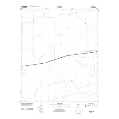
2010 Map of Newkirk
USGS Topo · Published 2010About this map
Newkirk serves as a primary waypoint in this high-desert landscape of Guadalupe County, defined by the modern infrastructure of Frontage Rd running parallel to the interstate corridor. The settlement is anchored by the Newkirk Post Office and the nearby Newkirk Cemetery, serving as a central hub for the surrounding ranching and rural residential land. To the north and south, the terrain transitions into the drainage basins of Pajarito Creek and Difrises Arroyo, while the prominent rise of Mesa del Gato dominates the central topography.
Find a feature on this map
16 named features on this map. Tap any name to fly to it.
Don’t see what you’re looking for? This feature index may not catch every label — zoom into the map to look around manually.
Map Details
Editions of this 2010 Newkirk Map
This is the sole edition of this map. No revisions or reprints were ever made.
Other maps of this area

1954 · Santa Fe
USGS Topo · 1:250,000

1954 · Fort Sumner
USGS Topo · 1:250,000

1958 · Fort Sumner
USGS Topo · 1:250,000

1958 · Santa Fe
USGS Topo · 1:250,000

1963 · Mesita Del Gato
USGS Topo · 1:24,000

1963 · Cuervo
USGS Topo · 1:24,000

1964 · Neafus Ranch
USGS Topo · 1:24,000

1964 · Gate Canyon
USGS Topo · 1:24,000

1964 · Newkirk
USGS Topo · 1:24,000
1964 · Salt Lake
USGS Topo · 1:24,000