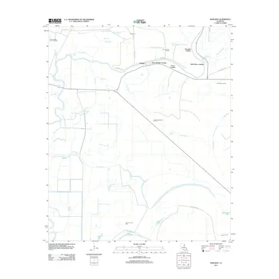
2012 Map of Newlight
USGS Topo · Published 2012About this map
Tensas River meanders across this low-lying landscape, defining the character of a region where water and petroleum dictate the economy. Along the river’s winding course, several riverfront sites like Remolina Landing, Pecan Landing, and Ferry Newlight Landing indicate the historical importance of river transport in Tensas Parish. The terrain is a complex network of wetlands and drainage features, including the aptly named Lake Misery, Skeeter Lake, and Bengal Slough.
Find a feature on this map
37 named features on this map. Tap any name to fly to it.
Don’t see what you’re looking for? This feature index may not catch every label — zoom into the map to look around manually.
Map Details
Editions of this 2012 Newlight Map
This is the sole edition of this map. No revisions or reprints were ever made.
Other maps of this area

1909 · Delta Bridge
USGS Topo · 1:24,000

1935 · Winnsboro
USGS Topo · 1:62,500

1935 · Shackleford Lake
USGS Topo · 1:62,500

1939 · Locust Ridge
USGS Topo · 1:62,500

1941 · Sicily Island
USGS Topo · 1:62,500

1953 · Natchez
USGS Topo · 1:250,000

1955 · Jackson
USGS Topo · 1:250,000

1956 · Natchez
USGS Topo · 1:250,000

1957 · Sicily Island
USGS Topo · 1:62,500

1958 · Shackleford Lake
USGS Topo · 1:62,500