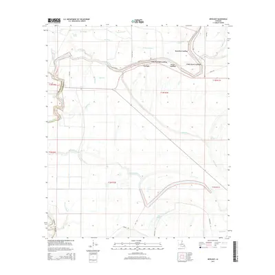
2015 Map of Newlight
USGS Topo · Published 2015About this map
Tensas River meanders sharply through this landscape on the Franklin Parish and Tensas Parish border, anchoring a series of historic river landings that once served as vital transportation nodes. The settlement of Newlight stands near Ferry Newlight Landing, part of a network of river-access points including Pecan Landing, Remolina Landing, and Glade Bayou Landing. The terrain is defined by a dense web of wetlands and watercourses, from the broad reaches of Big Bayou and Mound Bayou to the curious naming of Lake Misery. Smaller drainages like Bieler Bayou and Sandy Bayou carve through the alluvial plains, while local names such as Doc Case and Steel Gang suggest the human history and labor that shaped these lands. The map details the transition from the river's edge to the inland sloughs, tracing how roads like Newlight Rd follow the natural rises of the bottomland.
Find a feature on this map
38 named features on this map. Tap any name to fly to it.
Don’t see what you’re looking for? This feature index may not catch every label — zoom into the map to look around manually.
Map Details
Editions of this 2015 Newlight Map
This is the sole edition of this map. No revisions or reprints were ever made.
Other maps of this area

1909 · Delta Bridge
USGS Topo · 1:24,000

1935 · Winnsboro
USGS Topo · 1:62,500

1935 · Shackleford Lake
USGS Topo · 1:62,500

1939 · Locust Ridge
USGS Topo · 1:62,500

1941 · Sicily Island
USGS Topo · 1:62,500

1953 · Natchez
USGS Topo · 1:250,000

1955 · Jackson
USGS Topo · 1:250,000

1956 · Natchez
USGS Topo · 1:250,000

1957 · Sicily Island
USGS Topo · 1:62,500

1958 · Shackleford Lake
USGS Topo · 1:62,500