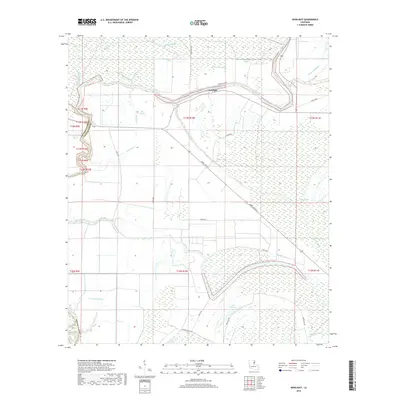
2018 Map of Newlight
USGS Topo · Published 2018About this map
The Tensas River meanders across this alluvial landscape, defining the boundary between Franklin Parish and Tensas Parish. The settlement of Newlight sits near a prominent bend in the river, connected to the surrounding wetlands by a network of local roads including Rural Route 2 and Steel Gang. The area is defined by its complex hydrology, where numerous bayous and sloughs like Big Bayou, Mound Bayou, and Bengal Slough drain the low-lying terrain into the primary river channel. This 2018 survey reveals a landscape where traditional agricultural land-use patterns, indicated by several labels for Turn Row, coexist with backwater environments such as Lake Misery and Lake Formosa. These water features, alongside smaller drainages like Three Buck Bayou and Cow Slough, illustrate the intricate drainage systems characteristic of the Louisiana delta country near the Tensas Basin.
Find a feature on this map
36 named features on this map. Tap any name to fly to it.
Don’t see what you’re looking for? This feature index may not catch every label — zoom into the map to look around manually.
Map Details
Editions of this 2018 Newlight Map
This is the sole edition of this map. No revisions or reprints were ever made.
Other maps of this area

1909 · Delta Bridge
USGS Topo · 1:24,000

1935 · Winnsboro
USGS Topo · 1:62,500

1935 · Shackleford Lake
USGS Topo · 1:62,500

1939 · Locust Ridge
USGS Topo · 1:62,500

1941 · Sicily Island
USGS Topo · 1:62,500

1953 · Natchez
USGS Topo · 1:250,000

1955 · Jackson
USGS Topo · 1:250,000

1956 · Natchez
USGS Topo · 1:250,000

1957 · Sicily Island
USGS Topo · 1:62,500

1958 · Shackleford Lake
USGS Topo · 1:62,500