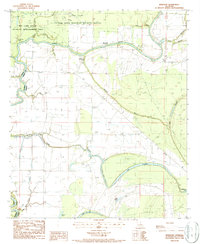
1987 Map of NewLight
USGS Topo · Published 1987About this map
The Tensas River meanders across this alluvial landscape, defining the character of a region heavily dedicated to conservation and flood management in the late 1980s. Large portions of the terrain are preserved within the Tensas River National Wildlife Refuge and the Big Lake State Wildlife Management Area, highlighting the importance of the bottomland hardwood habitat. Small clusters of human activity are centered at Newlight and Marydale, while the deeper history of the area is signaled by an Indian Mound and another Mound near the center of the sheet.
Find a feature on this map
30 named features on this map. Tap any name to fly to it.
Don’t see what you’re looking for? This feature index may not catch every label — zoom into the map to look around manually.
Map Details
Editions of this 1987 NewLight Map
This is the sole edition of this map. No revisions or reprints were ever made.
Other maps of this area

1909 · Delta Bridge
USGS Topo · 1:24,000

1935 · Winnsboro
USGS Topo · 1:62,500

1935 · Shackleford Lake
USGS Topo · 1:62,500

1939 · Locust Ridge
USGS Topo · 1:62,500

1941 · Sicily Island
USGS Topo · 1:62,500

1953 · Natchez
USGS Topo · 1:250,000

1955 · Jackson
USGS Topo · 1:250,000

1956 · Natchez
USGS Topo · 1:250,000

1957 · Sicily Island
USGS Topo · 1:62,500

1958 · Shackleford Lake
USGS Topo · 1:62,500