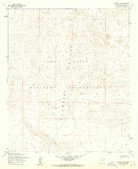
1955 Map of Newman NE
USGS Topo · Published 1962About this map
Fort Bliss Military Reservation dominates this mid-1950s terrain, covering nearly the entire quadrangle as the base expanded its training and testing footprint in the New Mexico desert. The landscape is defined by the broad expanse of the Tularosa Valley, where intricate contour lines reveal a complex network of dry washes and alluvial fans sloping away from the surrounding mountains. This specific survey was mapped by the Army Map Service and later published for civil use, providing a precise record of the topography and land use just before the height of the Cold War. While the map is devoid of permanent civilian settlements, it captures the intersection of military administration and the natural geography of Otero County, showing the vast open spaces that facilitated military operations in the region.
Find a feature on this map
4 named features on this map. Tap any name to fly to it.
Don’t see what you’re looking for? This feature index may not catch every label — zoom into the map to look around manually.
Map Details
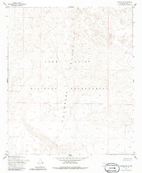
Editions of this 1955 Newman NE Map
2 editions found
Other maps of this area

1940 · Orogrande
USGS Topo · 1:62,500

1940 · Newman
USGS Topo · 1:62,500

1941 · Desert
USGS Topo · 1:62,500

1943 · Parker Lake
USGS Topo · 1:62,500

1943 · Desert
USGS Topo · 1:62,500

1943 · Newman
USGS Topo · 1:62,500

1943 · Orogrande
USGS Topo · 1:62,500

1948 · Davies Tank
USGS Topo · 1:24,000

1948 · El Wood
USGS Topo · 1:24,000

1948 · Newman NW
USGS Topo · 1:24,000