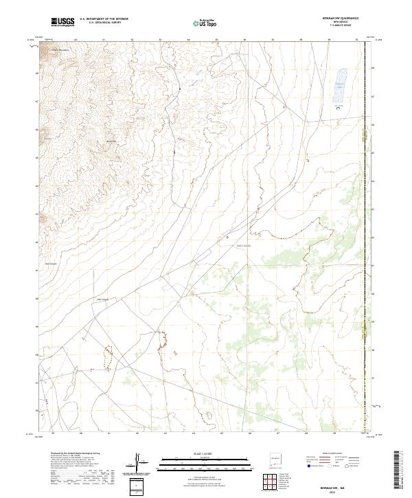
2023 Map of Newman NW
USGS Topo · Published 2023About this map
Fort Bliss covers a significant portion of this landscape along the border of Doña Ana and Otero Counties, characterizing the region as a high-desert military reservation. The terrain is defined by the sharp rise of the Organ Mountains in the northwest, transitioning into the Black Hills and Deer Hill. Several drainage patterns, including Oak Canyon, suggest the seasonal movement of water across the arid plains toward catchment points like Pit Tank. The presence of Old Coe Lake in the northeast provides a specific point of interest for those studying the hydrology of the Tularosa Basin. This modern survey reflects the continued use of the land for defense and training purposes, with infrastructure like War Rd cutting through the western sections of the quadrangle.
Find a feature on this map
10 named features on this map. Tap any name to fly to it.
Don’t see what you’re looking for? This feature index may not catch every label — zoom into the map to look around manually.
Map Details
Editions of this 2023 Newman NW Map
This is the sole edition of this map. No revisions or reprints were ever made.
Other maps of this area

1891 · Las Cruces
USGS Topo · 1:125,000

1893 · Las Cruces
USGS Topo · 1:125,000

1940 · Newman
USGS Topo · 1:62,500

1941 · Organ Peak
USGS Topo · 1:62,500

1943 · La Mesa
USGS Topo · 1:62,500

1943 · Parker Lake
USGS Topo · 1:62,500

1943 · Newman
USGS Topo · 1:62,500

1943 · Organ Peak
USGS Topo · 1:62,500

1948 · Davies Tank
USGS Topo · 1:24,000

1948 · Newman NW
USGS Topo · 1:24,000