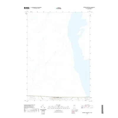
2021 Map of Newport Center OE N
USGS Topo · Published 2021About this map
The international boundary between the United States and Canada defines the northern reaches of this 2021 survey in Orleans County. The landscape is dominated by the southern tip of Lake Memphremagog, which stretches northward into Quebec. To the west, the terrain rises toward Bear Mt, providing a natural backdrop to the rural road network that includes Guay Farm Rd and Leadville Rd. Drainage in this borderland is captured by several small tributaries, most notably Mud Cr, which winds through the lower elevations. The map reveals a sparse, high-latitude settlement pattern where development is largely confined to scattered homesteads and logging access roads, highlighting the transition from the Vermont mountains into the lake basin shared by two nations.
Find a feature on this map
7 named features on this map. Tap any name to fly to it.
Don’t see what you’re looking for? This feature index may not catch every label — zoom into the map to look around manually.
Map Details
Editions of this 2021 Newport Center OE N Map
This is the sole edition of this map. No revisions or reprints were ever made.
Other maps of this area

1919 · Lake Memphremagog
USGS Topo · 1:62,500

1920 · Derby
USGS Topo · 1:62,500

1920 · Irasburg
USGS Topo · 1:62,500

1923 · Irasburg
USGS Topo · 1:48,000

1923 · Lake Memphremagog
USGS Topo · 1:48,000

1925 · Irasburg
USGS Topo · 1:62,500

1925 · Memphremagog
USGS Topo · 1:62,500

1950 · Lake Champlain
USGS Topo · 1:250,000

1953 · Irasburg
USGS Topo · 1:62,500
1953 · Memphremagog
USGS Topo · 1:62,500