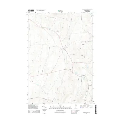
2015 Map of Newport Center
USGS Topo · Published 2015About this map
Newport Center serves as the focal point of this northern Vermont landscape, situated within a network of glacial hills and brook-fed valleys in Orleans County. The terrain is defined by prominent elevations such as Allen Hill, Coburn Hill, and Cleveland Hill, which overlook a series of small, pristine water bodies including Smith Pond, Sargent Pond, and Walker Pond. The drainage pattern is complex, with Dunn Brook, Stony Brook, and Beetle Brook carving through the countryside towards larger systems like the Black River and the southern tip of Lake Memphremagog visible in the northeast corner.
Find a feature on this map
53 named features on this map. Tap any name to fly to it.
Don’t see what you’re looking for? This feature index may not catch every label — zoom into the map to look around manually.
Map Details
Editions of this 2015 Newport Center Map
This is the sole edition of this map. No revisions or reprints were ever made.
Other maps of this area

1919 · Lake Memphremagog
USGS Topo · 1:62,500

1920 · Derby
USGS Topo · 1:62,500

1920 · Irasburg
USGS Topo · 1:62,500

1923 · Irasburg
USGS Topo · 1:48,000

1923 · Lake Memphremagog
USGS Topo · 1:48,000

1925 · Irasburg
USGS Topo · 1:62,500

1925 · Memphremagog
USGS Topo · 1:62,500

1950 · Lake Champlain
USGS Topo · 1:250,000

1953 · Irasburg
USGS Topo · 1:62,500
1953 · Memphremagog
USGS Topo · 1:62,500